Introduction
XCSoar is an Open Source software for tactical glide computer: run it on any PDA/Smartphone/eBook and you have a powerfull computer for sailplane, paradlider and hang glider. (see previous post about adding a GPS to an eReader)
The geo file format used by XCSoar are:
- elevation geotiff raster with altitude encoded (custom format)
- waypoints
- airspace
- any shapefile
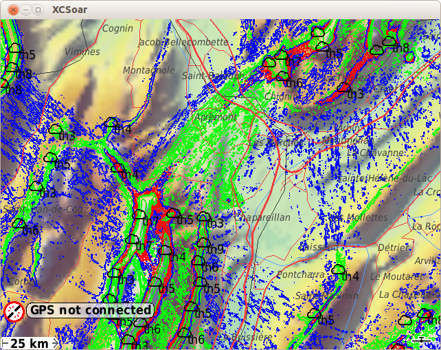
We will use the latest to add custom geo referenced information on XCSoar (in this case, paragliding skyways from thermal.kk7)
Software requirement
Processing files
#remove and create temp folder for file processing
rm -rf tmp/; mkdir tmp/
#convert PNG+PGW to GeoTiff and resize for faster processing (resize to any % or none)
gdal_translate ./skyways_all.png tmp/skyways_all.tif -outsize 50% 50%
#vectorize contour to shapefile red layer
gdal_contour tmp/skyways_all.tif tmp/skyways_all_r.shp -i 50 -b 1
#vectorize contour to shapefile green layer
gdal_contour tmp/skyways_all.tif tmp/skyways_all_g.shp -i 80 -b 2
#vectorize contour to shapefile blue layer
gdal_contour tmp/skyways_all.tif tmp/skyways_all_b.shp -i 200 -b 3
Visualisation with QGIS
Import from Layer->Add Vector Layer and select your 3 files
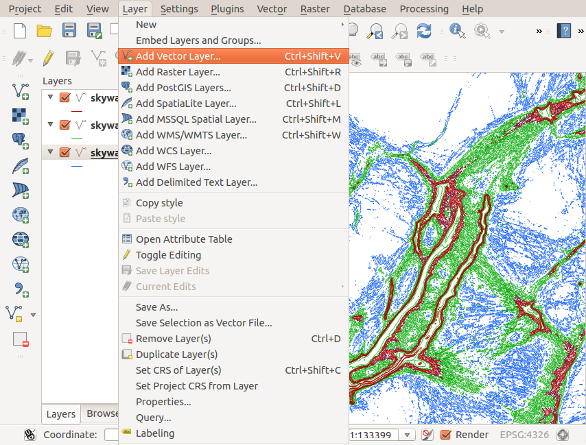 Then if everything is fine, save the 3 as Shapefiles:
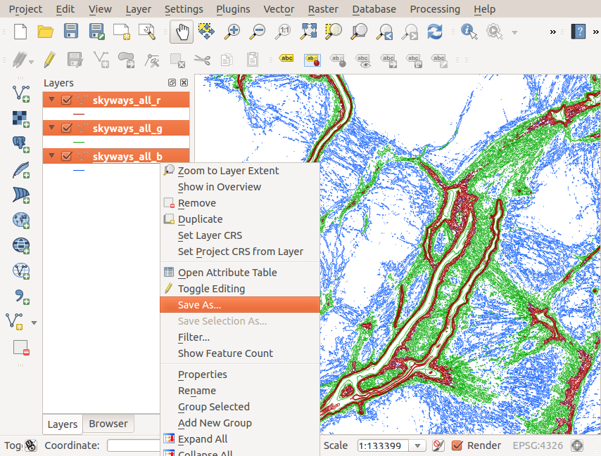
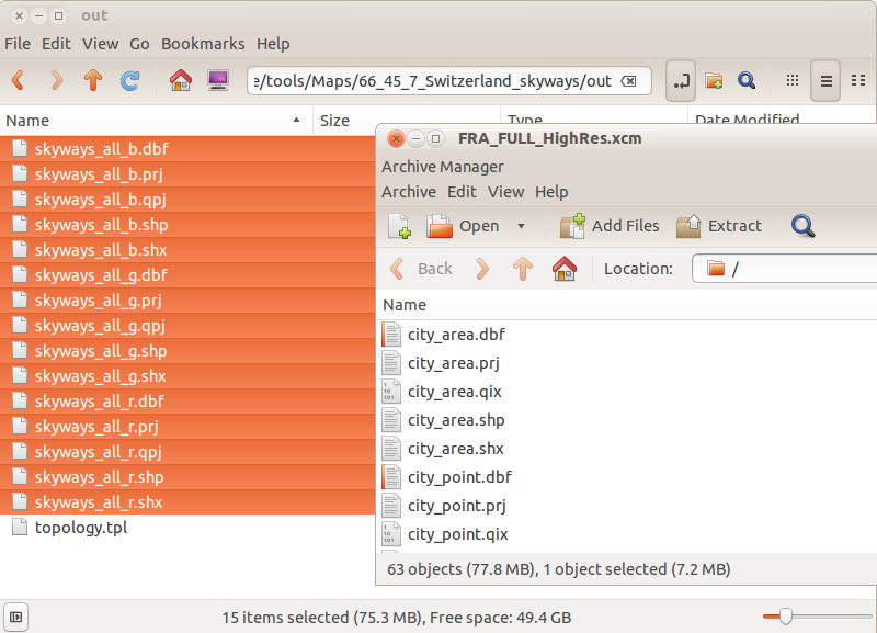
Place the generated file into the XCM (XCSoar compressed archive map)
 Dont forget to edit the topology.tpl to add the names of the new files:
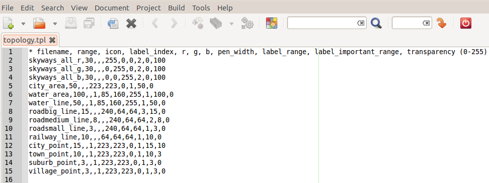 You can edit color (RGB, 0-255) and transparency (0-255)
The order is important: element are displayed from top to bottom (first to last)
Result
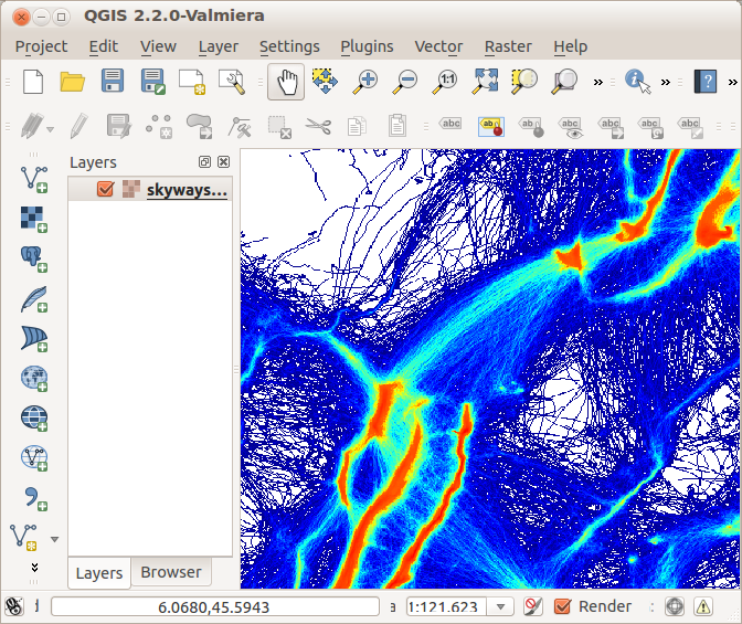
Original raster file, PNG + PGW format.
Generated shapefile maps in XCSoar (desktop version)
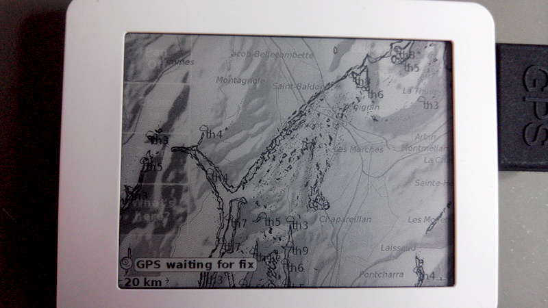
Same in XCSoar but eReader version optimised for black and white gray levels.
